

Up to the minute
Weather today
Temperature
14 °C / 27 °C
Sunshine hours
7 h


Forecast
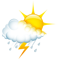
Weather forecast
DAILY WEATHER IN DETAIL
THE WEATHER TODAY
This very summery weather will continue into next week. Although a so-called high-pressure ridge is in effect at higher altitudes, some unstable air will reach us from the southwest at the start of the week. Despite passing veil clouds, pleasant weather conditions will often prevail. It is only as the day progresses that cumulus clouds will increase, which may lead to brief showers and thunderstorms. Muggy, unstable air masses from the western Mediterranean, combined with a weakening high-pressure system, will continue to bring unpredictable weather conditions. With this type of air mass, a detailed forecast in terms of both location and timing isn’t particularly useful, since conditions can unexpectedly flare up at any time and in any place. Surprises—both positive and negative—are simply part of this weather pattern. The dry and pleasant spells should be used for outdoor activities. In the second half of the week, temperatures are expected to trend slightly downward.
Wetterstationen
LIVE REPORT
CURRENT TEMPERATUREs
ALL WEATHER STATIONS IN ISCHGL
scroll
Up to the minute
The weather in Ischgl
Real-time information from your holiday region
Sunscreen, windbreaker or umbrella? To come perfectly prepared for your holiday adventure in the Paznaun valley, it’s a good idea to have a look at the weather forecast. Weather you’re headed for a ski resort or the region’s hiking trails – we have all the information you need for your upcoming trip.
Our forecasts keep you informed on things like the snow line, sunshine hours, rain probability and the daily maximum and minimum temperature. Plus, we’ll keep you up to date on the average wind speed and the current avalanche warning level.
Stay Tuned & Stay involved
What inspires – and what matters


